| Galilee Salt Marsh |
Aerial Map |
| Galilee Salt Marsh |
Aerial Map |
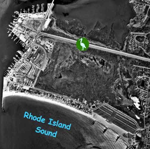
The Escape Road is one of the most noticeable features in this aerial photograph. The road runs in a basically east- west direction and the Galilee salt marsh symbol lies directly over it. This is to show that the field trip area lies on both sides of the road. The healthy marsh, the Bluff Hill Cove marsh, is on the north side of the road while the unhealthy or restored marsh, in the Galilee Bird Sanctuary, lies on the south side of the road.