 | |||||
 |
Policy and ManagementGreenwich BayGreenwich Bay is a shallow, small estuary of only five square miles located on the western side of Narragansett Bay. In 1992, a severe storm washed large numbers of bacteria from contaminated groundwater, farmland, and storm drains into Greenwich Bay, resulting in a complete closure of the Bay to shellfishing for one and a half years. This event led to the creation of the Greenwich Bay Initiative, a group of federal, state and local organizations. The goal of the Initiative is to bring back Greenwich Bay's water quality for its ecological, recreational, and economical benefits. Their strategy is to address Greenwich Bay's problems on a watershed basis, by looking at the land that contributes runoff and stream flow to the Bay. By improving the water quality of downstream areas, valuable habitats can be restored. These habitats, like eelgrass beds and salt marshes, further help to improve water quality by filtering pollutants, consuming nutrients, and causing sediments to settle out of the water. While the Bay is now reopen during dry weather, storms with over half an inch of rain still trigger a shellfishing closure. 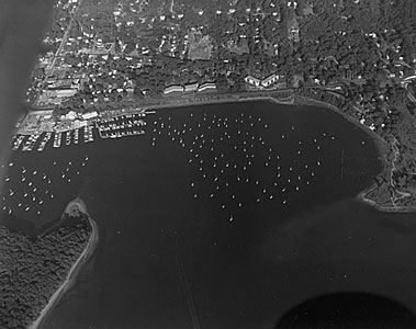 Greenwich Bay (Courtesy of RI Sea Grant) (For more information on Greenwich Bay visit the following Sea Grant web site: http://risg.gso.uri.edu/G_Bay)
|
||||