2. How do we measure salinity?
Salinity is often measured by measuring how well electricity travels through the water. This property of water is called conductivity. Water that has dissolved salt in it will conduct electricity better than water with no dissolved salt. The more salt that is dissolved in the water, the better the water conducts electricity. The salt content of the water can be measured very precisely using the conductivity method.
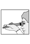
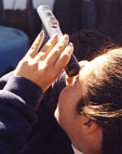
Salinity can also be measured with a hand held refractometer. A refractometer measures the change of direction or bending of the light as it passes from air to water. Light moves slower in water than air. The more salt in the water, the slower the light moves.
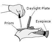   
You can see the effect of light bending (refracting) as it passes from the water into the air by placing a pencil in a glass of water.
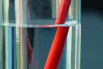
The pencil appears to bend where it enters the water. The pencil is not really bent. The light we see has bent as it moves from water to air.
A refractometer is the best choice for measuring salinity when only approximate values are needed. Refractometers are easy to use in the field and relatively inexpensive.
| Method of Salinity Measurement |
 |
Precision |
|
| Hand-held refractometer |
|
1 part in 70 |
|
| Laboratory titration |
|
1 part in 350 |
|
| Modern salinometer (conductivity) | |
1 part in 40,000 |
|
| (From Pilson, 1998) |
|